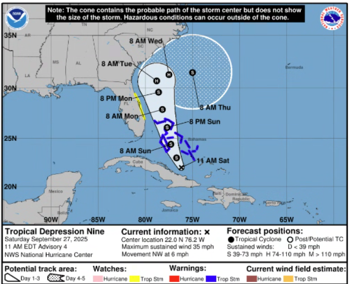
Tropical Depression 9 Update #2
The latest track of Tropical Depression 9, still expected to be Tropical Storm Imedla, has the storm being pulled out to sea before any landfall, mainly due to interaction with Hurricane Humberto. Even though the trends are looking better for the Hilton Head Island area, we still need to keep a close eye on the development, because where the turn occurs will dictate potential impacts for the SC coast.
HAZARDS & IMPACTS
- Forecast remains VERY Uncertain for TD 9. Potential impacts include:
- Prolonged Heavy Rainfall (if system slows/stalls), with localized amounts of 10 inches possible
- Strong Winds, especially along the coast, beginning as early as late Monday/Monday night
- Prolonged Coastal Flooding/Storm Surge possible due to persistent northeast/onshore winds
- Tornadoes possible
Please keep a close eye on the weather, as conditions can change quickly. For the latest forecast please visit https://www.nhc.noaa.gov/
In the event of an emergency or natural disaster, please look to your county and local government officials, along with the PDPOA and trusted media sources.